Machine Recycling Discussion and Moderated Newsgroup > Full Machines
> Complete Machines
> Woodwworking
> South
> New sokkia axis 3 gps system with data collector
New sokkia axis 3 gps system with data collector
Axis3 Complete GIS/GPS System- NEW with Jette Data Collector/IMap Software... Ready to go to Work for you!
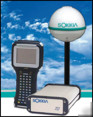
Axis3 GPS System with Jett CS Data Collector
Price includes Antenna, Cable, Backpack, System, Batteries and charger
Preowned Axis3 GPS System from Sokkia
The Sokkia Axis system with IMap! Sokkia s Sokkia Axis is the complete mapping/GIS data acquisition system that provides accurate, real-time positioning to collect GIS data. The system works wherever you need it to by providing a variety of real-time solutions that can be used virtually anywhere in the world. Sokkia s compact, lightweight, yet rugged Sokkia Axis system is designed to combine ease of use with valuable mapping and database functionality, making it the solution to all of your GIS/data collection needs.
There is no subscription fee for beacons or WAAS, but there is for OmniStar. The subscription can be by month or year or any other time period (even weekend use). Accuracy varies on correction method used, but is typically sub-meter to 3 meters. For example, 0.5 meter accuracy (1.5 feet) is common with beacon corrections when located within 60 miles of a Coast Guard beacon. The Axis 3 is designed for GIS and environmental applications, which are effectively addressed by SurvCE through use of attributing on feature codes and through ESRI import and export features.
Simplify your work Sokkia Axis features a 12- channel, L1 GPS receiver with three different internal real-time solutions to meet the unique needs or your job. Choose between freely available beacon or Wide Area Augmentation System (WAAS) corrections, or use a satellite based differential service to get accurate and real-time positions. Never before has a receiver offered so much so easily.
Compact and rugged By integrating beacon and satellite differential corrections into one receiver and antenna, Sokkia Axis eliminates the need for extra cables to provide a system with exceptional durability.
Familiarity is key IMap s sensible workflow and intuitive Windows CE interface enable you to feel comfortable from the start. Windows CE provides a wealth of features not available to proprietary data collectors.
Increase productivity and efficiency Graphically view and interact with your data to improve results. Load ESRITM SHP and MapInfo MIF files, as well as TIFF, GeoTIFF, aerial and satellite photos for in-field data verification.
IMap works your way IMap is available standard on a Pocket PC collector, complete with a reflective, liquid crystal display and color screen, providing enhanced readability even in bright light. The rugged, yet lightweight design enables you to capture data efficiently and productively.
Trust your data With easy-to-interpret GPS status, IMap gives you the up-to-the-second positional information you need when you need it to ensure accurate data collection and dependable graphical navigation. You can even configure IMap to collect GPS data on the go, at designated time or distance intervals.
Sokkia Axis with IMap:Perfect Partners With the powerful Sokkia Axis receiver seated comfortably in your pack and IMap at your fingertips, you can pinpoint features to submeter accuracy anywhere. Include IMap s capability to work with laser range finders and you have almost limitless positioning options in a system that weighs in at less than 3.6 kg (8lbs).
Field to finish Use IMap in the field to create feature and attribute files, edit your data, navigate and export in industry standard formats, including ESRITM SHP, AutoCAD and DXF, customizable ASCII, and more!
IMap PC (optional) Optional office software extends IMap s functionality. Additional features include file creation, graphical waypoint selection, and waypoint importing printing and customizable coordinate system creation.
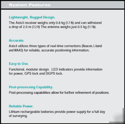
* Meet the challenge of any job The Axis3 receiver is designed for multiple applications and features state-of-the-art digital architecture. With enough battery life to last an entire day!
* Simplify your work Axis3 features a 12 channel , L1 GPS receiver with three different internal real time solutions to meet the unique needs of your job. Choose between freely available beacon or Wide Area Augmentation System (WAAS) corrections, or use a satellite based differential service to get accurate and real time positions.
* Compact and rugged By integrating beacon and satellite differential corrections into one receiver and antenna. Axis3 eliminates the need for extra cables to provide a system with exceptional durability.
MHz Tuning Mode Manual or Automatic
Sensitivity 120 dBm for <10-3 BER
Horizontal Accuracy <1m (DRMS)*
Input/Output Protocol NMEA 0183
Frequency Range 283.5 to 325 kHz
Cold Start Time < 1 minute typical
Reacquisition Time 2 seconds typical
Operating Temp -32C to +74C (-26F to 165F)
Storage Temp -40C to +85C (-40F to 185F)
Dimensions 51mm H x 125mm W x 190mm L
Dimensions 129mm dia. X 98mm H
Relative Humidity 100% Condensing
Palmetto Equipment and Supply, Inc.


